We instinctively bring space and place into our stories. Every day, we talk about places that mean something to us—whether it’s the city where we grew up, a neighborhood corner shop, a historic monument, or a natural landmark. Places are woven into our conversations effortlessly. We might mention the bus stop near our home, a favorite café down the street, a serene lake close to Manchester, or even countries across Europe. Each place has a name and a meaning, giving depth to our stories and helping others imagine where they unfold.


When it comes to capturing spatial data for analysis, the simplicity of our daily language fades into a web of complexity. In the world of geography and data, locations are given codes and classifications that vary by type, usage, and source. This structure suits the needs of fields like urban and environmental planning, where technical precision is essential. But when we want to tell a story or understand space through a more human lens, this technical system feels rigid and distant. It lacks the natural fluidity of how we think and talk about places.
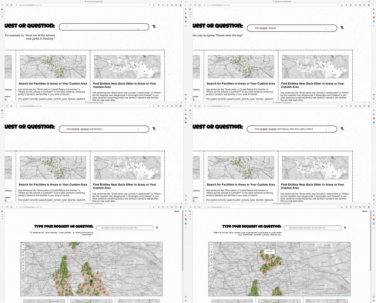
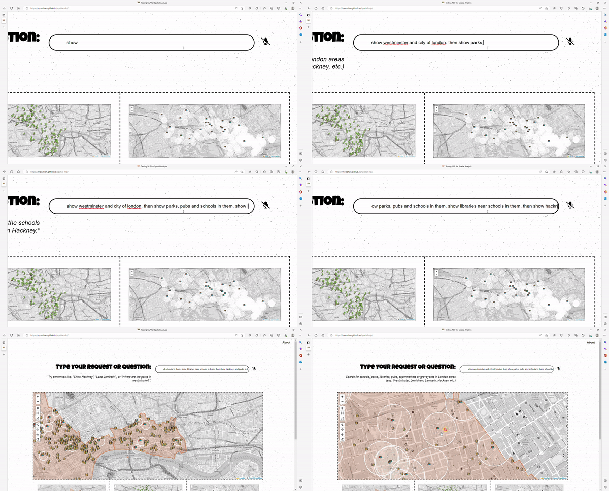
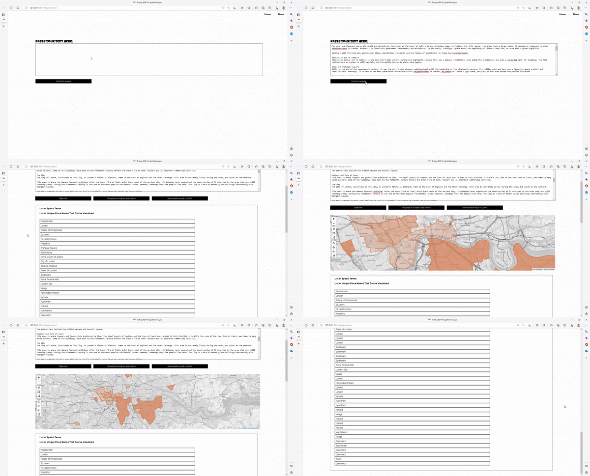
To bridge this gap, We’ve developed UrbanLinguist using natural language processing and spatial analysis tools. The goal is simple: to create a system that can capture spatial data in the flow of daily conversation, turning everyday language into meaningful spatial insights. While the current interface may remind you of Google Maps, this prototype is powered by spatial queries rather than place names. It allows us to ask questions like "What features lie within this boundary?" or "Where do two areas intersect?"—all without needing technical codes or classifications. This approach not only makes spatial data accessible but opens up new ways of seeing and sharing our world.
Contact us on hello@sealonthebeach.com for more information.


